Real Time Kinematic (RTK) is a Global Navigation Satellite Systems (GNSS) enhancement technique that uses a fixed base station (either on site or remote using Networked Transport of RTCM via Internet Protocol – NTRIP – over cellular or Wi-Fi) to transmit correction data to a mobile GNSS receiver such as a “rover” or a Unmanned Aircraft System (UAS). Using the GNSS signal’s carrier wave instead of the so-called pseudorandom code, the base station transmits the phase of the carrier wave it observes from each satellite to the mobile unit. The mobile unit then compares this with its own measurements and calculates its position relative to the base station to within a few millimetres. Assuming the base station is positioned on a known surveyed point, RTK can provide centimetre level absolute accuracy of the mobile unit’s position.
When applied to aerial mapping with drones, RTK can provide centimetre level accuracy of the UAs position when the photograph is taken. The position data can be written into the image file using EXIF and XMP tags which can be read by photogrammetry software to accurately position each camera when creating the point cloud. Traditional mapping using unmanned aircraft relies on ground control points (GCPs) to provide the required accuracy, as standard GNSS receivers commonly fitted in UAS are only accurate to within a few metres. Marking and surveying these points can often take longer than flying the mission itself. RTK can largely eliminate the need for GCPs, however it is standard practice to survey some control to ensure height accuracy, and to use as check points to verify the global accuracy of the outputs.

Accuracy of RTK surveys also depends on the image resolution, known as Ground Sample Distance (GSD, measured in metres, centimetres or millimetres per pixel), the higher the image resolution the lower the GSD. Resolution is dependent on sensor size, lens and mission height above ground. For surveys to RICS accuracy band G – suitable for 1:500 scale surveys – a maximum GSD of 2cm/px is appropriate. We can provide a GSD down to 1mm/px using the M300 RTK.
The aerial datasets are normally used in conjunction with ground surveying for GCP collection and topographic features that can’t be fully surveyed with aerial data. Examples are ditch depths, building footprints (aerial data captures building driplines that may extend further than the actual footprint), and to record and identify various objects and services that are not obvious from the air.
We operate three UAS that use RTK positioning, the DJI M300 RTK, Mavic 3 Enterprise and Mavic 3 Multispectral. Correction data are provided from several sources depending on the location: our own NTRIP stream from our base station in Lerwick, a local NTRIP stream over Wi-Fi or cellular from a base positioned on or near the job site, or via our DJI D-RTK2 GNSS station, again positioned on or near the site.
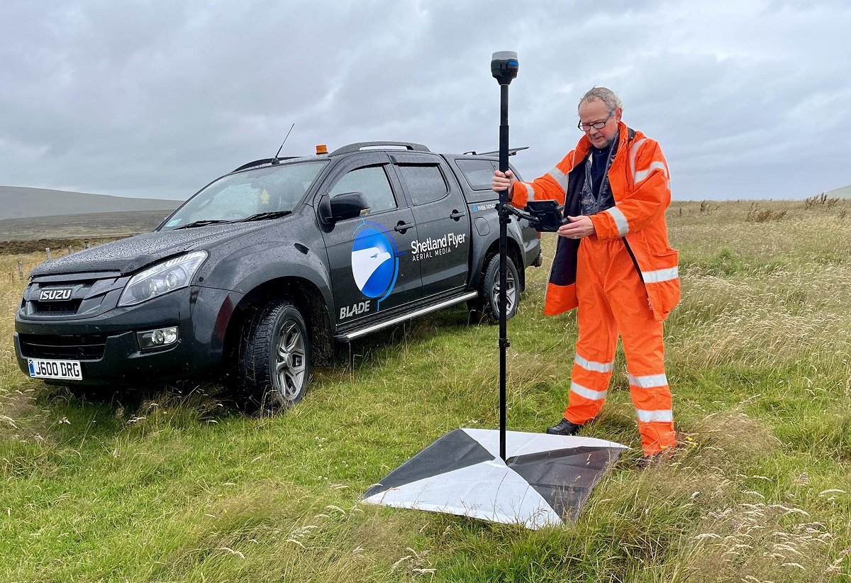
For base stations and RTK surveying we use the excellent Emlid Reach series of GNSS receivers, including the RX, RS2+ and the latest RS3 with tilt compensation, essential for surveying building footprints and hard to access areas. Our permanent base station uses a Reach RS2 that connects directly to the internet via Wi-Fi.
We offer a range of deliverables for topographic surveys, including orthomosaic and Digital Elevation Model (DEM), 2D and 3D CAD drawing with TIN surface and full linework in industry standard DWG format, and point cloud in a range of formats including LAS, E57 and RCS/RCP for direct AutoCAD™ and Civil3D™ import.